

What you can do with AgencyZoom on GeoMaps
- Plot every record on an interactive map — geocoded automatically.
- Filter by any field and save the views you come back to.
- Layer on routes, heatmaps, territories and demographic data.
- Keep your map in sync as your CRM data changes.
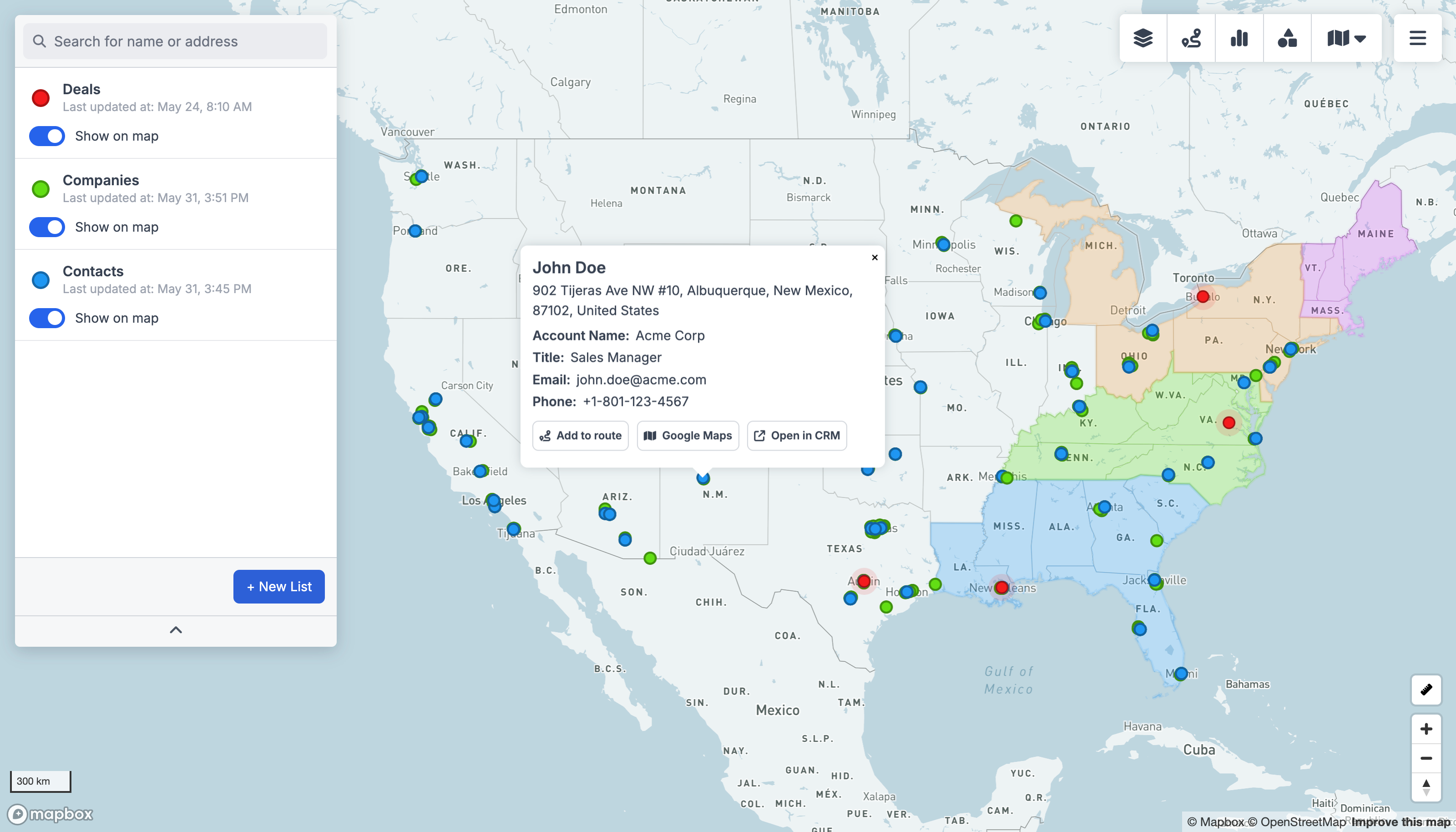
Why map your AgencyZoom data
AgencyZoom keeps your customers and leads in order, but a list of addresses never shows you where your business actually is. Connect AgencyZoom to GeoMaps and every record is geocoded and placed on an interactive map automatically — ready to filter, route, theme and share, with no spreadsheets of latitude and longitude and no GIS expertise required.
Insurance agencies live and die by territory: mapping your AgencyZoom book of business next to your open leads shows which neighbourhoods are already covered, where a producer should be door-knocking, and which renewals are worth a visit.
Once your AgencyZoom data is on the map you can plan optimized routes, build heatmaps, territories and drive-time areas, and explore real examples in the sales mapping gallery.
How to connect AgencyZoom
Create a free account
Sign up for GeoMaps — no credit card required.
Connect AgencyZoom
Choose AgencyZoom from the data sources and authorize the connection.
Pick the records to map
Select the objects you want and GeoMaps geocodes and plots them instantly.
AgencyZoom mapping FAQ
- How do I put AgencyZoom customers and leads on a map?
- Connect AgencyZoom to GeoMaps in a couple of clicks, pick the records you want, and GeoMaps geocodes every address and plots it on an interactive map — you don't need a column of coordinates or any mapping software.
- Does GeoMaps keep my AgencyZoom map up to date?
- Yes — GeoMaps refreshes from AgencyZoom so the map reflects new and updated customers and leads without manual exports.
- Can I filter and segment the AgencyZoom map?
- Yes. Filter by any field from AgencyZoom, save the views you use most, and layer on routes, drive-time areas, heatmaps and territories so the map becomes something your team can act on — not just look at.
- Is there a free way to map AgencyZoom data?
- Yes. GeoMaps is free for up to 1,000 locations with no credit card, so you can map and share your AgencyZoom data before deciding whether to upgrade.


