
What auto-create territories does
- Choose 2 to 30 territories for any list of records
- Build them from whole US ZIP codes or US counties
- Balance by number of records or the total of a number field, like revenue
- Preview each territory's total and % of the average before saving
- Each territory is kept in one connected piece where the area allows
- Saved as normal, editable layers in a new folder
- Start from the ⚡ button in the Layers panel, or straight from an empty Layers panel
Built from ZIP codes, close to home
For a single metro area, build territories from ZIP codes: here, 4 even patches around Dallas–Fort Worth by number of accounts, ready to hand to reps.
Check the numbers before you save
The preview shows each territory's total, its % of the average and how many ZIP codes or counties it covers. Change the number of territories or what you balance by and preview again.
Auto-create Territories in GeoMaps
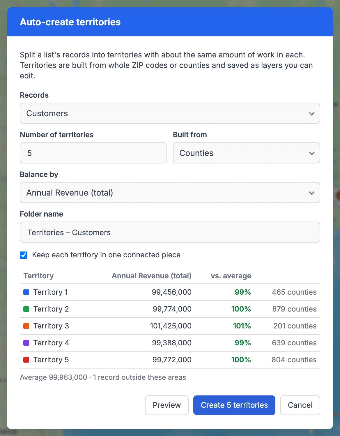
Drawing fair territories by hand takes hours of moving borders around and counting accounts. Auto-create does the first pass for you: choose a list of records, a number of territories (2 to 30), whether to build them from US ZIP codes or US counties, and what should be even: the number of records, or the total of a number field such as annual revenue.
Before anything is saved, the preview lists every territory with its total and how it compares with the average. Territories are made of whole ZIP codes or counties and kept in one connected piece where the area allows. In our testing, every territory landed within about 1 to 3% of the average (5 territories by revenue across the US by county, and 4 by ZIP code in Texas).
When you're happy, GeoMaps saves the territories as ordinary layers in a new folder. You can rename them, recolor them, edit their borders and use them in filters like any other layer, and keep an eye on them later with Balance territories.
It's part of GeoMaps' tools tools, so it works hand in hand with the rest of your map.
Where auto-create territories helps
Splitting a region between reps
Give every rep a patch with about the same number of accounts or the same revenue, instead of guessing from a map of dots.
Planning a new hire
Preview what 5 territories look like against 6 before you hire, and see how much each patch would shrink.
Field service and delivery areas
Split jobs or customers into even areas so each technician or driver gets a fair share of the work.
Auto-create Territories FAQ
- Which areas can territories be built from?
- US ZIP codes or US counties. Territories are always made of whole areas, so they line up with the boundaries your team already knows. Countries outside the US aren't supported yet.
- What can I balance by?
- The number of records in the list, or the total of any number field, such as annual revenue or monthly spend.
- My records are spread across the whole country. Should I use ZIP codes?
- Counties usually work better at that scale. For nationwide lists built from ZIP codes, GeoMaps only uses the ZIP codes that contain records, tells you so, and suggests counties instead.
- Can I change the territories afterwards?
- Yes. They're saved as ordinary layers in a new folder, so you can rename, recolor and edit them, or use Balance territories to even them out again later.