
What arcgis layers does
- Paste a FeatureServer or MapServer layer URL, or a whole service and pick a layer
- ArcGIS Online and ArcGIS Enterprise item pages and ArcGIS Hub dataset links work too
- Readable field aliases; dates and coded values shown as text
- Click any shape to see its attributes
- Works with the Layer assigned filter, shared maps and layer editing
- Reload from the saved URL to pick up the latest data
- Public layers up to 20,000 features / 10 MB each
Paste a service, pick a layer
Paste a MapServer or FeatureServer service URL and GeoMaps lists its layers. Pick one, here US cities, and it lands on the map as a GeoMaps layer.
Know what you're adding
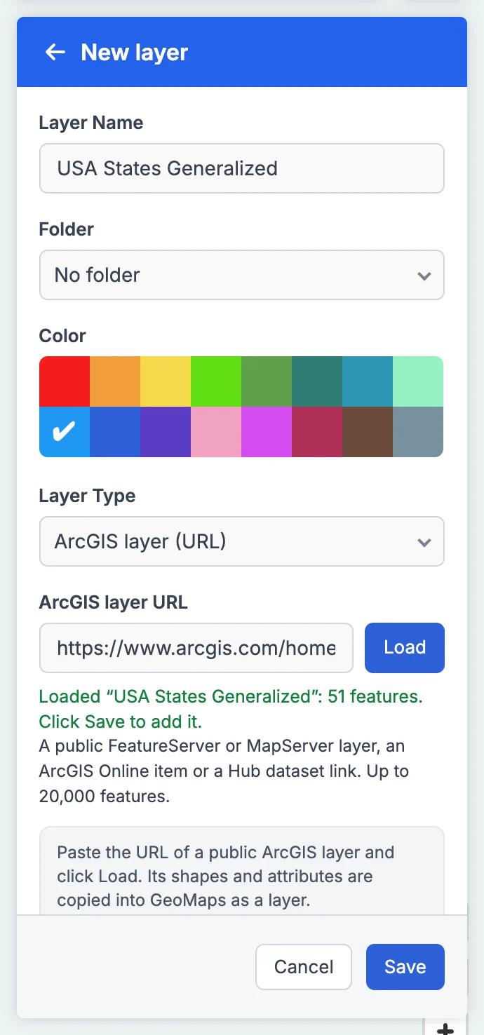
Before you save, GeoMaps tells you what it loaded and how many features came in. Name the layer, pick a color and a folder, and it's ready to use with the rest of your map.
ArcGIS Layers in GeoMaps
Cities, counties, utilities and agencies publish a huge amount of map data on ArcGIS: zoning, service areas, school districts, flood zones and more. With ArcGIS layers you can put any public one next to your own records without downloading and converting files. Choose New layer → ArcGIS layer (URL) in the Layers panel and paste a link.
GeoMaps accepts a FeatureServer or MapServer layer URL, a service URL (it lists the service's layers so you can pick one), an ArcGIS Online or ArcGIS Enterprise item page, or an ArcGIS Hub dataset link. Field names are shown with their readable aliases, and dates and coded values appear as readable text.
Once loaded, it's an ordinary GeoMaps layer: click a shape to see its attributes, use it in the Layer assigned filter, share it on a map and edit it. GeoMaps keeps the source URL, so you can reload the layer later to get the latest data.
It's part of GeoMaps' tools tools, so it works hand in hand with the rest of your map.
Where arcgis layers helps
Government boundaries and zoning
Bring a city's zoning or a county's districts onto the map from its open-data portal and see which of your records fall inside.
Risk and environmental layers
Overlay public hazard or environmental layers on your customer or property list to spot the ones that need attention.
Utility and service areas
Load published service territories to check coverage, plan outreach or route field teams.
ArcGIS Layers FAQ
- Which ArcGIS links can I paste?
- A FeatureServer or MapServer layer URL, a service URL (GeoMaps lists its layers to pick from), an ArcGIS Online or ArcGIS Enterprise item page, or an ArcGIS Hub dataset link.
- Can I use layers that need an ArcGIS sign-in?
- Not yet. GeoMaps can load public layers only for now.
- How large can a layer be?
- Up to 20,000 features or 10 MB per layer. For bigger datasets, filter the layer in ArcGIS first or use a smaller layer.
- Does the layer update automatically?
- No. It's copied once when you load it. GeoMaps keeps the URL, so you can reload the layer any time to get the latest data.