
How to Convert Excel to KML or KMZ for Google Earth (Free)

Excel is where most location lists live: customers, stores, job sites, survey points. Google Earth speaks KML. Excel has no "Save as KML" option, so getting a spreadsheet into Google Earth takes one extra step. This guide shows the fastest way to convert Excel to KML or KMZ, how to prepare the sheet so every row lands in the right place, and what to do when the conversion fails.
KML or KMZ: which one do you need?
Both work in Google Earth, Google My Maps and most GIS tools. The difference is packaging:
| KML | KMZ | |
|---|---|---|
| What it is | Plain XML text | A KML zipped into one file |
| Size | Larger | Much smaller, easier to email |
| Opens in | Google Earth, My Maps, GIS, any text editor | Google Earth, My Maps, GIS |
| Pick it when | You want to read or edit the file | You want to send or share it |
If you're unsure, choose KMZ for sharing and KML if another tool will process the file.
Step 1: Prepare the spreadsheet
The converter needs to know where each row is. That means two columns of coordinates in decimal degrees:
- A latitude column, named Latitude, Lat or Y (latitud also works).
- A longitude column, named Longitude, Long, Lng, Lon or X (longitud also works).
- Values like 32.7767 and -96.7970. Longitudes in the Americas are negative; latitudes south of the equator are negative.
Every other column (name, address, type, owner, phone…) is carried into the KML as an attribute of the placemark, so keep whatever you'll want to see when you click a pin in Google Earth.
A few things that trip people up:
- Only addresses, no coordinates? Convert them first with the free batch geocoder (up to 100 per run), which adds latitude and longitude columns. See how to convert addresses to latitude and longitude for larger lists.
- Degrees-minutes-seconds (32°46'36"N) won't be read as numbers. Convert them to decimal degrees first.
- Swapped columns put your points in the wrong hemisphere. If Dallas shows up in Antarctica, latitude and longitude are reversed.
- One sheet only. The first worksheet in the workbook is converted, so move the list you want to the first tab.
- Lines and polygons can come from a column of WKT geometry (POLYGON((…))) instead of latitude/longitude.
Step 2: Convert Excel to KML (or KMZ)
Open the Excel to KML converter and drag in your .xlsx file (.xls and .xlsm work too). The conversion runs in your browser: the file is never uploaded, which matters for customer lists. You get a feature count, a download button, and a map preview of the result.
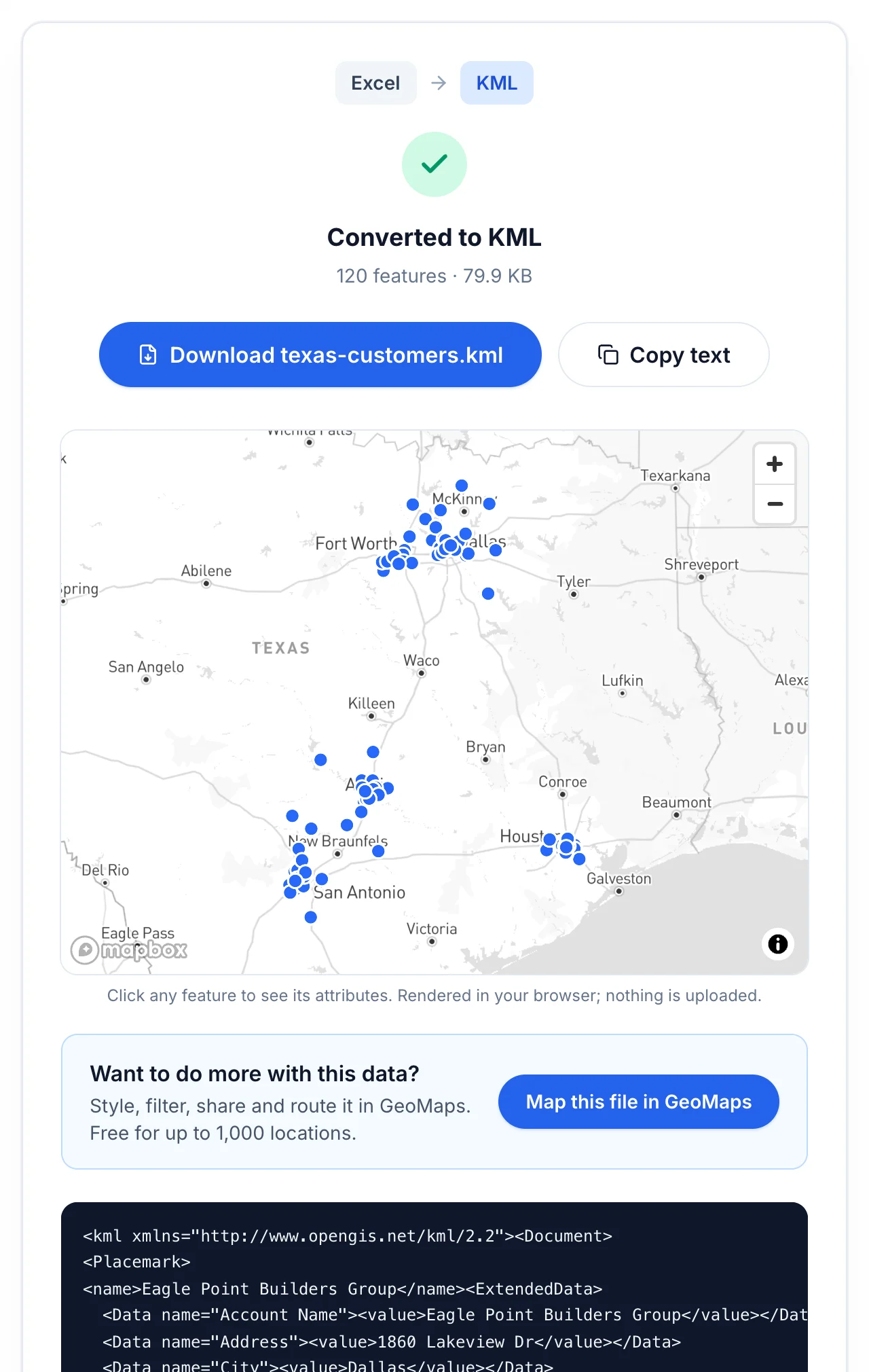
Click any point on the preview to check it. Every column from the spreadsheet should be there:
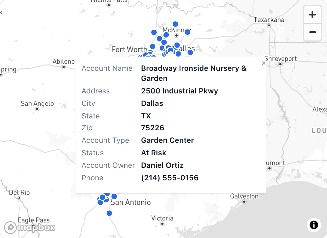
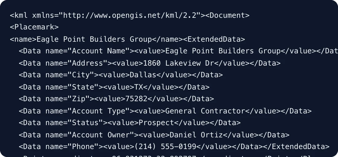
The placemark's label (its KML name) comes from the first name-like column, such as Name, Title or Account Name, so Google Earth shows "Eagle Point Builders Group" next to the pin instead of an untitled marker. Under the hood, each row becomes a placemark with its columns stored as ExtendedData:
Download the file. For KMZ, use the Excel to KMZ converter instead. It's the same process, and you get a single compressed file.
Step 3: Open it in Google Earth
- Google Earth Pro (desktop): File → Open, and choose the .kml or .kmz. The placemarks appear in the Places panel under Temporary Places. Drag them to My Places to keep them.
- Google Earth on the web: create a project, then import the KML or KMZ file from your computer.
- Google My Maps: in a layer, click Import and choose the file. Mind the limits: 2,000 rows per layer and 5 MB per KML/KMZ import. See every Google My Maps limit.
Once the pins are in Google Earth, you can change their icons and colors there, add folders, or tour them in 3D.
Troubleshooting
- "No map features were found": the converter couldn't find coordinate columns. Check the column names and that the values are numbers, not text with degree symbols.
- Fewer placemarks than rows: rows with empty coordinates can't be placed. Fill them in, or geocode their addresses.
- Points in the ocean at 0, 0 ("Null Island"): some rows have zeros instead of coordinates. Fix or remove them.
- Everything is one color: KML from a spreadsheet has no styling. Restyle in Google Earth, or use a mapping tool that colors pins by a column (see below).
- The file is huge: use KMZ, which is compressed.
When a KML file isn't enough
A KML file is a snapshot: the moment someone updates the spreadsheet, the map in Google Earth is out of date, and you convert and send it again. If the spreadsheet changes often, or the map is for a team, a live map is the better fit.
In GeoMaps you import the Excel file (or connect Google Sheets or a CRM) once. Pins are colored by any column, filtered, searched and routed, and the map can be shared with your team. With a connected source, edits flow through without re-exporting.
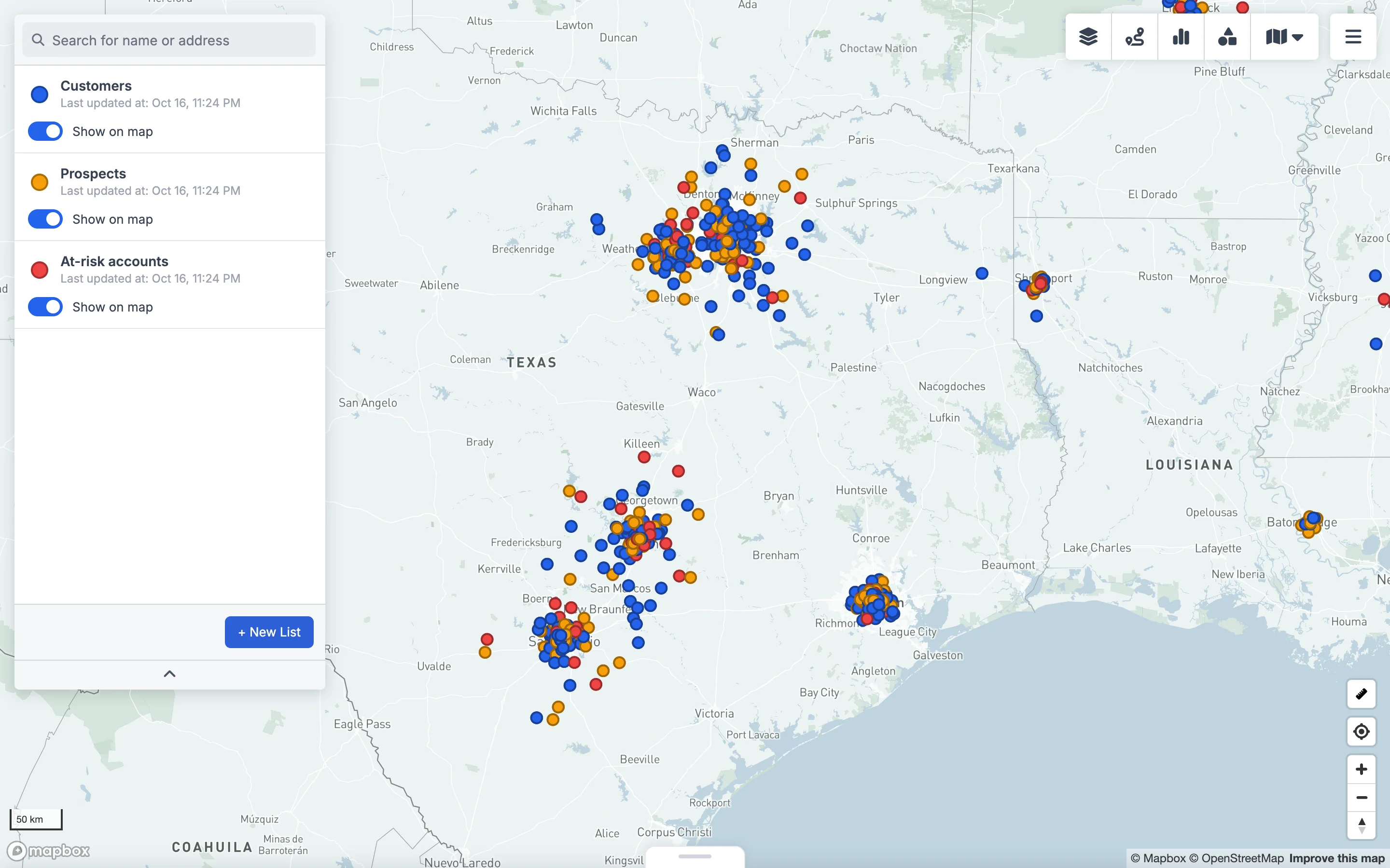
You can try GeoMaps free for 14 days, and the converters stay free for exporting to KML, KMZ or any other format.
FAQ
- How do I convert an Excel file to KML?
- Make sure the sheet has latitude and longitude columns in decimal degrees, then upload the .xlsx to a free Excel to KML converter such as geomaps.co/convert/excel-to-kml and download the KML. Every other column becomes an attribute of the placemark.
- Can Excel export KML directly?
- No. Excel has no KML or KMZ export. You need a converter, a GIS tool such as QGIS, or Google Earth Pro's own import of text/CSV files.
- Can I convert Excel addresses to KML without coordinates?
- Not directly. KML stores coordinates, so addresses must be geocoded first. Use a batch geocoder to add latitude and longitude columns, then convert the file.
- What is the difference between KML and KMZ?
- A KMZ is a KML file compressed into a ZIP archive. It contains the same data but is much smaller, which makes it easier to email and share. Google Earth opens both.
- Is it safe to convert a customer list online?
- With the GeoMaps converter, yes: the conversion runs entirely in your browser and the file is never uploaded to a server. Check how any other online converter handles your data before using it.
- How do I get KML back into Excel?
- Use the reverse converter, KML to Excel (geomaps.co/convert/kml-to-excel). Each placemark becomes a row with its name, attributes, latitude and longitude.