
Google My Maps Limits (2026): 2,000 Rows, 10 Layers & What to Do Next
Google My Maps is the default way to put a spreadsheet on a map: it's free, it's already in your Google account, and it works for a few hundred pins. Then the data grows, and an import fails or a layer fills up. This guide lists every Google My Maps limit, explains the one that catches most people off guard, and covers your options when you outgrow it.
Every Google My Maps limit at a glance
| Limit | Google My Maps | What it means in practice |
|---|---|---|
| Layers per map | 10 | Each import creates a layer, so 10 imports and you're out |
| Places, lines or shapes per layer | 2,000 | A layer can't hold more than one full import |
| Places, lines or shapes per map | 10,000 | The ceiling even with all 10 layers full |
| Rows per imported file | 2,000 | Bigger CSV, Excel or Sheets files must be split first |
| Data-table cells per map | 20,000 | Rows × columns across every layer combined |
| Points in lines and shapes | 50,000 | Detailed territory outlines and long routes use it up fast |
| KML / KMZ import size | 5 MB | Large boundary files need simplifying first |
| Other import files | 40 MB | Rarely the bottleneck — row and cell counts bite first |
Sources: Google's My Maps Help pages on importing data, layers and lines and shapes.
The limit most people miss: 20,000 data cells
The 2,000-row rule gets all the attention, but the 20,000 data-table cell cap is often what actually stops an import. Every imported column counts, and the limit applies to the whole map, not to one layer. The maximum number of rows depends on how wide your spreadsheet is:
| Columns in your sheet | Most rows the map can hold |
|---|---|
| 5 | 4,000 |
| 10 | 2,000 |
| 15 | 1,333 |
| 25 | 800 |
| 40 | 500 |
A typical CRM export has 20 to 40 columns, so it can run out of room at a few hundred rows. Before importing, delete every column you don't need on the map — usually everything except the name, the address and the two or three fields you want in the pin's info window.
What happens when you hit a limit
- Too many rows: Google's guidance is simply not to import files with more than 2,000 rows, so treat it as a hard ceiling and split the file.
- A full layer: new places have to go into another layer, and you only get 10.
- A full map: at 10,000 features (or 20,000 cells) the only option is a second map — and separate maps can't be viewed or filtered together.
- Changed data: an import is a snapshot. When the spreadsheet changes, you re-import (My Maps has a Reimport and merge option per layer) or the map goes stale.
Workarounds that keep you in Google My Maps
- 1Split the file into 2,000-row chunks and import each into its own layer — for example one layer per region or per sales rep.
- 2Trim columns to stay under the 20,000-cell limit.
- 3Use one map per region if you have more than 10,000 locations, and accept that they can't be combined.
- 4Simplify shapes before importing KML/KMZ boundaries to stay under 50,000 points and 5 MB.
- 5Convert the format if your data is in GPX, GeoJSON or a Shapefile: our free CSV to KML and Shapefile to KML converters run in your browser.
These buy time, but every one of them adds manual work you'll repeat each time the data changes.
Signs you've outgrown Google My Maps
- You have more than 2,000 locations, or you will soon
- Your data lives in a CRM or a Google Sheet that changes every week
- You want to color and filter pins by several fields, not one
- You need heatmaps, territories, radius or drive-time searches
- You plan routes for field visits, not just one-off directions
- Several people need the same map with their own permissions
How to map 2,000+ locations in GeoMaps
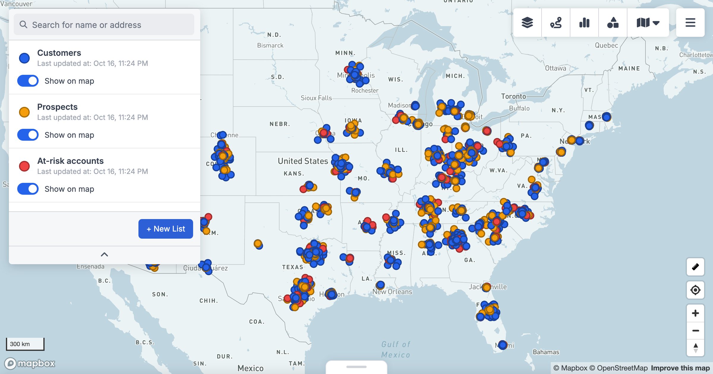
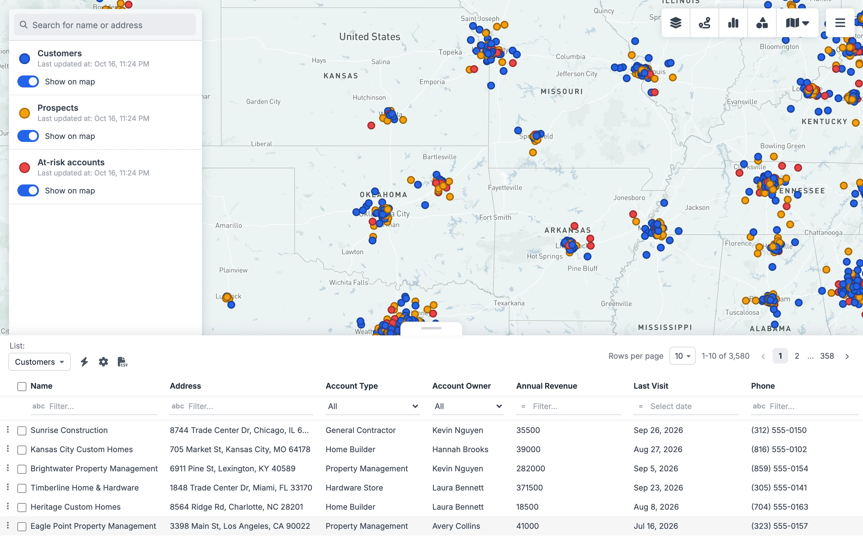
GeoMaps was built for the point where My Maps stops: thousands of rows, data that changes, and teams that work from the map every day. Here's the same workflow with 6,214 B2B accounts — three times the per-layer limit — from a single spreadsheet.
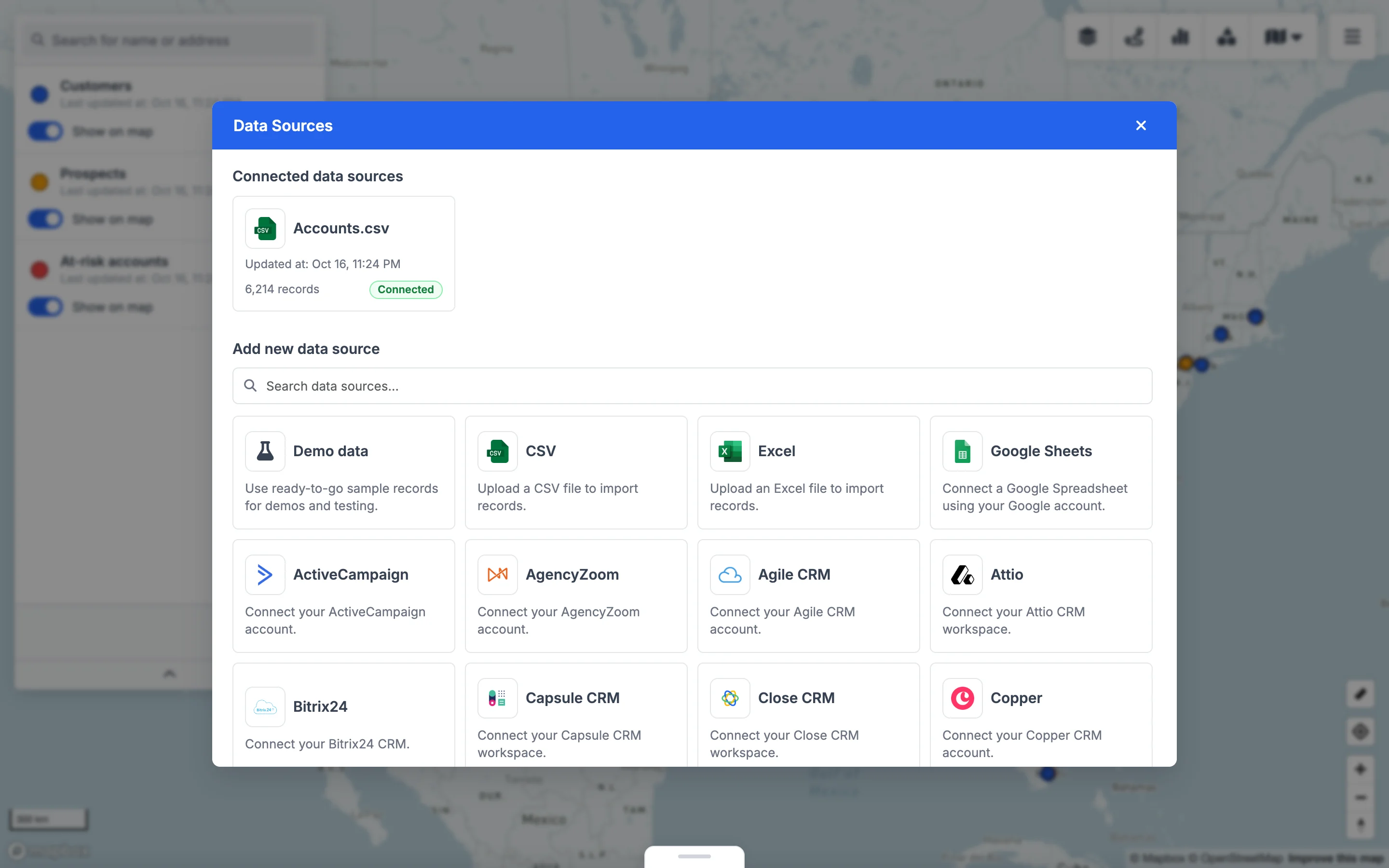
- 1Add your data. Upload a CSV or Excel file of any length, or connect Google Sheets or one of 15 CRMs so the map stays in sync without re-importing.
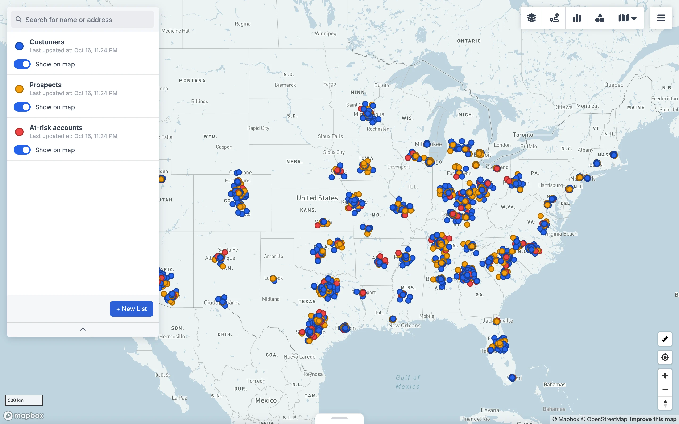
- 2Map it. Addresses are geocoded automatically. Split the data into colour-coded lists by any field — here Customers, Prospects and At-risk accounts from the Status column.
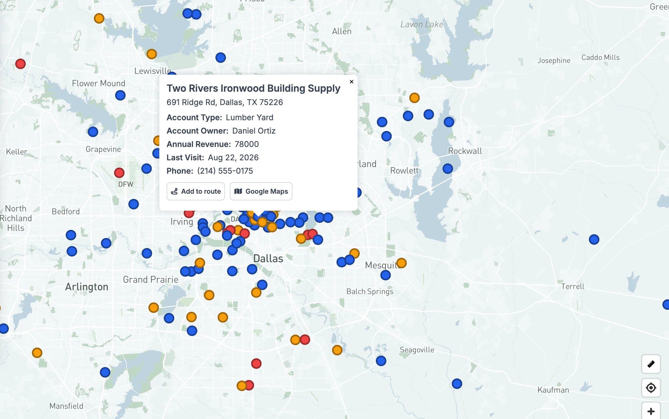
- 3Click any pin for the full record. Choose which columns appear in the popup, then add the stop to a route or open it in Google Maps.
- 4Work the data as a table. Filter every column, sort, select records for a route and export to CSV — over thousands of rows, not one layer at a time.
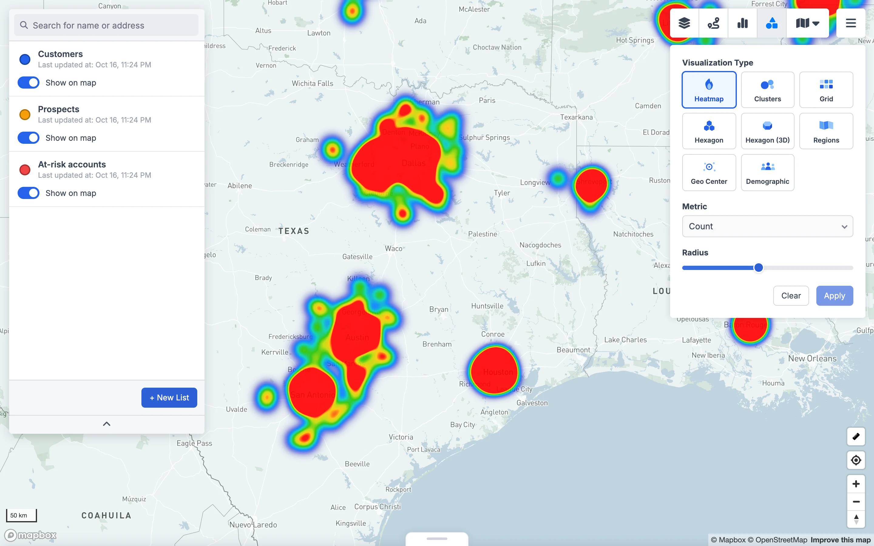
- 5See the patterns. Switch to a heatmap, hexagons, a grid or regions to see where your accounts concentrate.
Google My Maps vs GeoMaps
| Google My Maps | GeoMaps | |
|---|---|---|
| Price | Free | Free up to 1,000 locations; paid plans for more |
| Locations per map | 10,000 (2,000 per layer) | 20,000 on Pro, 100,000 on Enterprise |
| Import size | 2,000 rows per file | No per-file row limit |
| Keeping data current | Manual reimport | Google Sheets and 15 CRMs sync automatically |
| Filtering | Style by one column per layer | Lists and filters on any field, plus a table view |
| Heatmaps, hexbins, territories | No | Yes |
| Routes | Directions for a few stops | Optimized multi-stop routes |
| Team access | Share via Google account | Workspace with roles, public and embedded maps |
When Google My Maps is still the right choice
My Maps is genuinely good for small, static maps: a trip itinerary, a few dozen store locations, an event map you embed once. It's free, familiar and lives in Google Drive. If you're under a few hundred places and the data rarely changes, you don't need anything else — our step-by-step Google My Maps guide will get you there. When you're past the limits above, see our list of Google My Maps alternatives or the My Maps vs GeoMaps comparison.
FAQ
- How many points can Google My Maps hold?
- Up to 10,000 places, lines or shapes per map, with no more than 2,000 in a single layer and a maximum of 10 layers.
- What is the Google My Maps import row limit?
- Google advises against importing files with more than 2,000 rows. KML and KMZ files are limited to 5 MB, and other file types to 40 MB.
- Why won't My Maps import my spreadsheet even though it has fewer than 2,000 rows?
- The likely cause is the 20,000 data-table cell limit, which counts rows × columns across the whole map. A 25-column sheet runs out at 800 rows. Delete the columns you don't need and import again.
- Does Google My Maps update automatically when my Google Sheet changes?
- No. Imports are snapshots — you have to use Reimport and merge on the layer. GeoMaps keeps a connected Google Sheet or CRM in sync automatically.
- Is there a free alternative to Google My Maps for more than 2,000 locations?
- Most mapping tools limit their free plans too. GeoMaps is free for up to 1,000 locations; the Pro plan maps up to 20,000 and Enterprise up to 100,000.