
How to Draw a Radius on Google Maps (Free Workarounds That Work)

"Show me everything within 10 miles of our office." It sounds like a basic map feature, but Google Maps has no radius tool: you can measure a straight line between two points, but you can't draw a circle. This guide shows the workarounds that do work, including a free way to draw an accurate radius and open it in Google Maps or Google Earth, and when a radius is the wrong shape for the job.
Can you draw a radius in Google Maps?
No. Google Maps (the regular app and website) has no circle or radius drawing tool, and Google My Maps, its custom-map sibling, doesn't either. My Maps lets you draw lines and polygons by hand, but a hand-drawn "circle" is a rough polygon and its size is a guess.
What Google Maps *can* do:
- Measure a straight-line distance between points: right-click on the map, choose Measure distance, then click a second point. Handy for one-off checks ("is the client within 10 miles?"), useless for seeing an area.
- Display a circle someone else made, if you import it into Google My Maps as a KML file. That's the workaround below.
Method 1: Draw the radius with a free tool, then open it in Google Maps
This is the fastest way to get an accurate circle you can share.
- 1Open the free radius map and type an address, city or ZIP code, or just click the map.
- 2Enter the radius in miles or kilometers. For several rings at once, separate them with commas: 5, 10, 25.
- 3Add more locations if you need them (up to 25: offices, stores, depots).
- 4Click KML (or KMZ) to download the circles.
The circles are true geodesic distances, measured on the curved surface of the earth, so a 25-mile ring is 25 miles in every direction, at any latitude. (Circles drawn in screen pixels, as some quick tools do, get distorted the further you are from the equator.)
Then put them on a Google map:
- Google My Maps: create a map, click Import on a layer, and choose the KML file. Each circle becomes a shape you can recolor and share with a link.
- Google Earth: in Earth Pro, use File → Open; on the web, import the KML file into a project.
Bonus: count what's inside each radius
The question behind a radius map is usually "how many of our customers are within 10 miles?" The radius map answers that directly. Upload your customer list (a CSV or Excel file with latitude and longitude columns, or a KML/GeoJSON file) and each location shows how many points fall inside each ring:
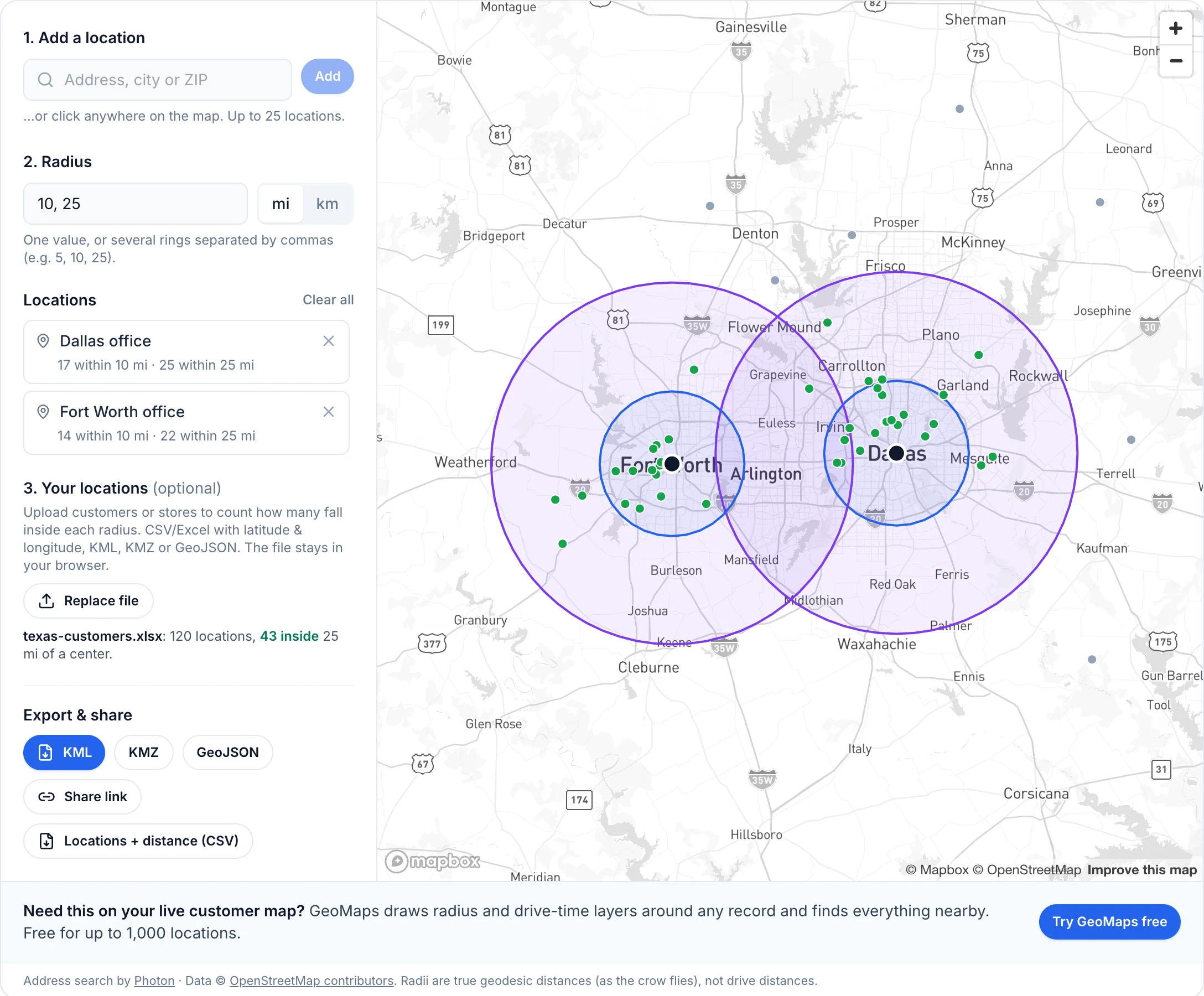
You can also download your list with the distance to the nearest location added, ready to sort in Excel. The file never leaves your browser. If your list has addresses but no coordinates, convert them first with the free batch geocoder.
Method 2: Google Earth Pro's ruler
Google Earth Pro on desktop has a ruler (the ruler icon in the toolbar) with a Circle tab: click a center, drag outward, and it shows the radius, area and circumference. It's accurate and free, but it's a measuring tool, not a map layer, so it's awkward for comparing several locations or sharing with a team.
Method 3: Keep the radius on your live customer map
A KML circle in My Maps is a snapshot: it sits next to a copy of your data that goes stale the moment the spreadsheet or CRM changes. When the radius is part of how your team works, put it on the map where your data already lives.
In GeoMaps, a radius is a layer. Open Layers → New layer, choose Radius, pick the center by address or by clicking the map, and set the miles:
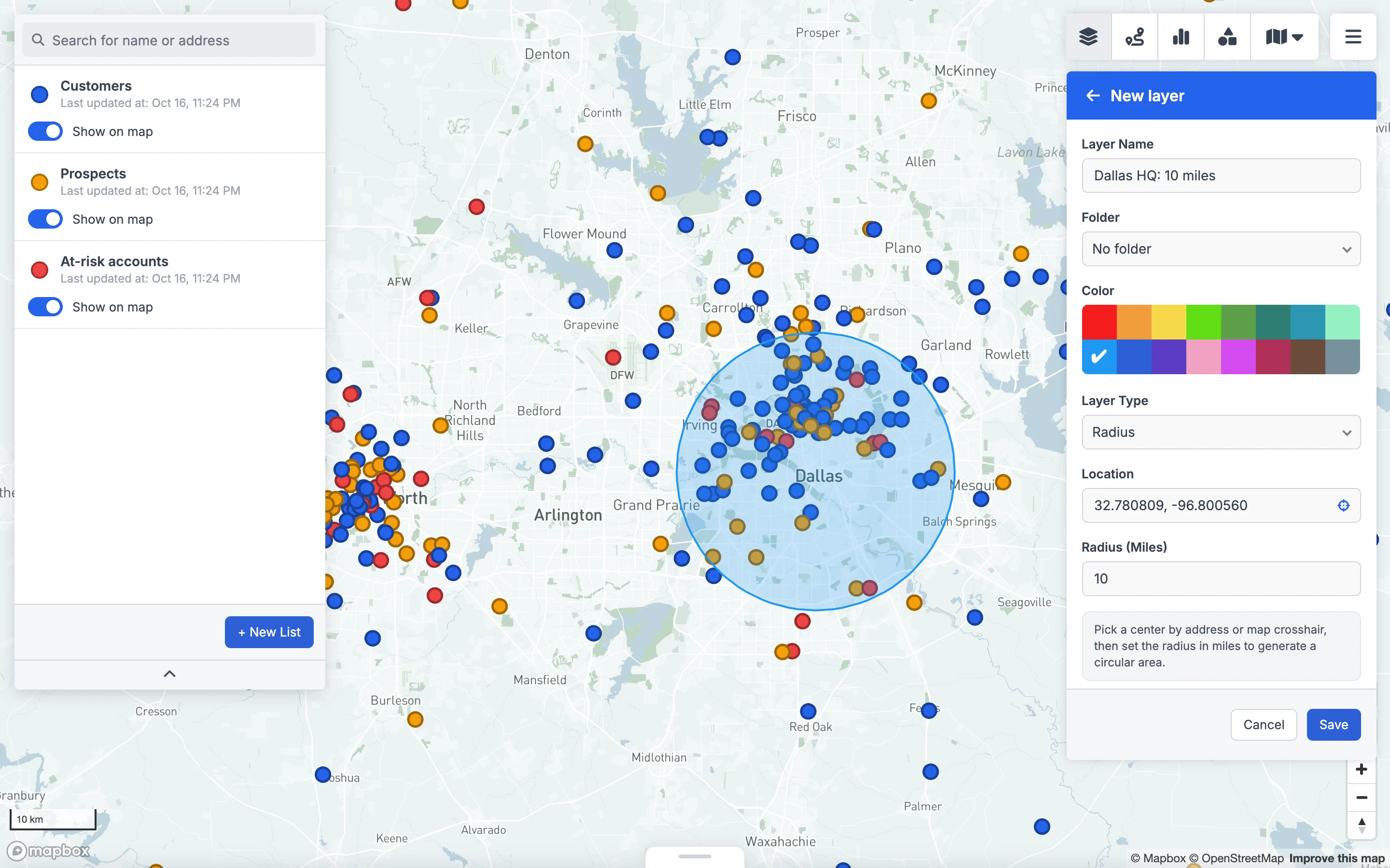
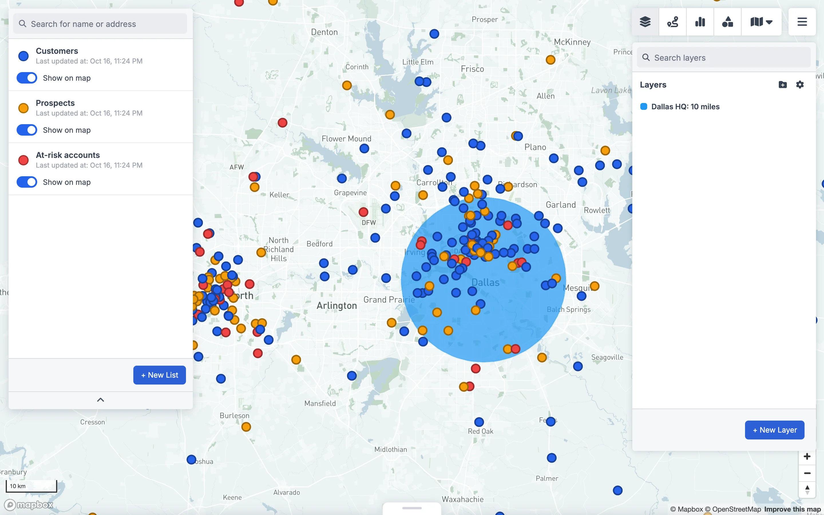
Save it, and the radius stays on the map over your accounts, which stay in sync with your spreadsheet or CRM. You can filter records by the area they fall in, find everything near any record, and share the map with your team.
Radius or drive time?
A radius is distance as the crow flies, and real travel doesn't work that way. Ten miles along an interstate takes ten minutes; ten miles across a city, a river or a mountain can take an hour. For delivery promises, service areas or anything a customer will hold you to, a drive-time area (an isochrone) is the more honest shape.
| Radius | Drive time | |
|---|---|---|
| Shape | Perfect circle | Follows the road network |
| Answers | "How far is it?" | "How long does it take to get there?" |
| Good for | Marketing areas, quick coverage checks, eligibility rules | Delivery and service areas, site selection, rep territories |
| Free tool | Radius map | [Drive time map](/drive-time-map) |
Both tools export to KML, so either shape can go into Google My Maps or Google Earth.
FAQ
- How do I draw a 10-mile radius on Google Maps?
- Google Maps has no radius tool. Draw the 10-mile circle with a free radius map tool, download it as KML, and import the file into Google My Maps (on a layer, click Import), which displays it on a Google map you can share.
- Can Google My Maps draw a circle?
- No. My Maps can draw lines and polygons but not circles. Import a circle made elsewhere as a KML file instead. It keeps its exact size and shape.
- How do I measure distance in Google Maps?
- On a computer, right-click your starting point and choose Measure distance, then click anywhere else on the map. Google Maps shows the straight-line distance, and you can add more points to measure a path.
- Is a radius distance the same as driving distance?
- No. A radius is a straight line in every direction. Driving distance follows roads, so it's always longer, and travel time depends on the roads. Use a drive-time map when travel time matters.
- How do I find all customers within a radius?
- Upload your customer list (with latitude and longitude, or geocode the addresses first) to the free radius map. Each location shows how many customers fall within each ring, and you can download the list with distances added. For a live version on your CRM or spreadsheet data, use a radius layer in GeoMaps.