
GeoMaps vs Smappen
Smappen (formerly Oalley) is a location-intelligence tool for territory design and market analysis. Its specialty is catchment areas: draw drive-time (isochrone), radius or boundary-based territories on real road networks, then overlay built-in demographics — population, income, age, employment — plus a database of millions of businesses and points of interest. It's popular with franchisors and retailers for site selection and territory planning.
GeoMaps starts from your own data rather than market data. It connects live to CRMs, spreadsheets and databases, plots your records on an interactive map, generates maps with AI, optimizes multi-stop routes, and publishes customer-facing maps. Both can draw drive-time and radius areas, but they're built for different jobs — here's an objective comparison.
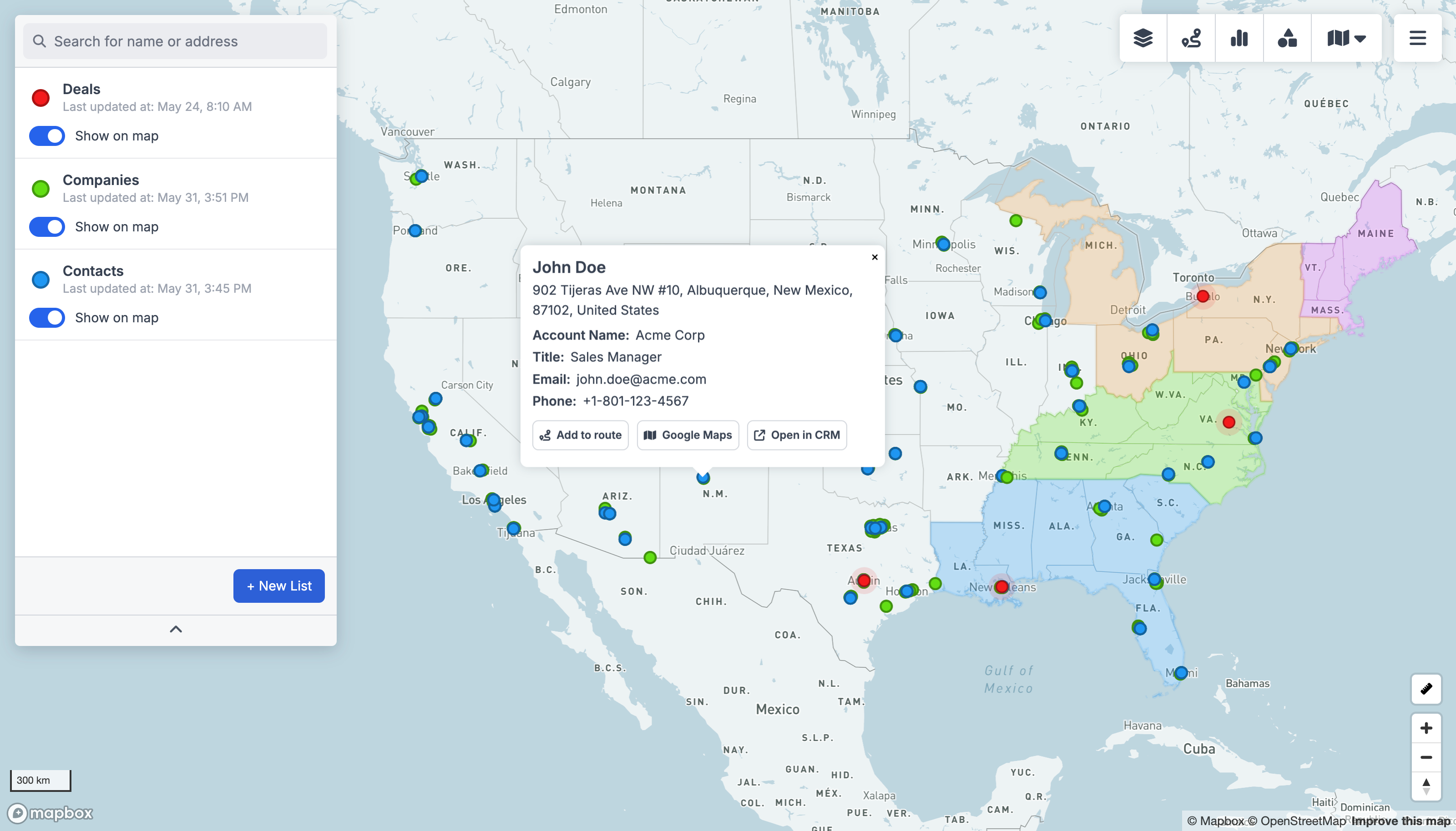
GeoMaps vs Smappen, feature by feature
| Feature | GeoMaps | Smappen |
|---|---|---|
| Map your CRM / spreadsheet data | 20+ live connectors | import, no live sync |
| Live CRM data sync | ||
| AI map generation | ||
| Drive-time & radius areas | core strength | |
| Built-in demographic data | region layers | rich, built-in |
| Competitor / POI database | millions of places | |
| Route planning & optimization | ||
| Public / customer-facing maps | shareable reports | |
| Free plan | 1,000 locations | free tier, limited |
built-in · partial / on roadmap · not available. Competitor details are our objective read and can change — check their site for the latest.
Connect the tools you already use
GeoMaps syncs live from your CRM, spreadsheet or database — no manual re-imports. A few of the 20+ native connectors:
See all integrations Attio
Attio LeadConnector
 Close
Close Copper
 Salesmate
 Google Sheets
 Excel
Excel Less Annoying CRM
Choose Smappen if…
your main job is market analysis and territory design — drawing catchment areas with built-in demographics and competitor data for site selection or franchise planning.
- Built-in demographic data (population, income, age, employment) layered onto every territory you draw.
- A large database of businesses and points of interest for competitor and market analysis.
- Deep catchment-area analysis — drive-time isochrones on real road networks — plus branded market-analysis reports.
- Purpose-built for franchise territory design and retail site selection.
Choose GeoMaps if…
you want to map and act on your own CRM, spreadsheet or database records — with live sync, AI map generation, route optimization and customer-facing maps.
- Connect a live CRM, spreadsheet or database and keep your own records in sync on the map.
- Generate maps with AI and optimize multi-stop routes for field teams.
- Publish branded, customer-facing maps (store locators, listings) you update from your data.
- Start free for up to 1,000 locations — no credit card required.
GeoMaps vs Smappen FAQ
- Is GeoMaps a good Smappen alternative?
- It depends on the job. If you want to map your own CRM, spreadsheet or database records with live sync, AI generation, routing and customer-facing maps, GeoMaps is a strong fit. If you mainly need demographic market analysis and catchment-area site selection, Smappen is purpose-built for that.
- What does Smappen do better than GeoMaps?
- Smappen has rich built-in demographic data and a large business/POI database layered onto drive-time catchment areas, plus branded market-analysis reports — making it stronger for site selection, market research and franchise territory design.
- Does GeoMaps do drive-time and catchment areas?
- Yes — GeoMaps can draw radius and drive-time (isochrone) layers around any location. Smappen goes deeper on demographics and competitor data inside those areas, while GeoMaps focuses on plotting and acting on your own live data.